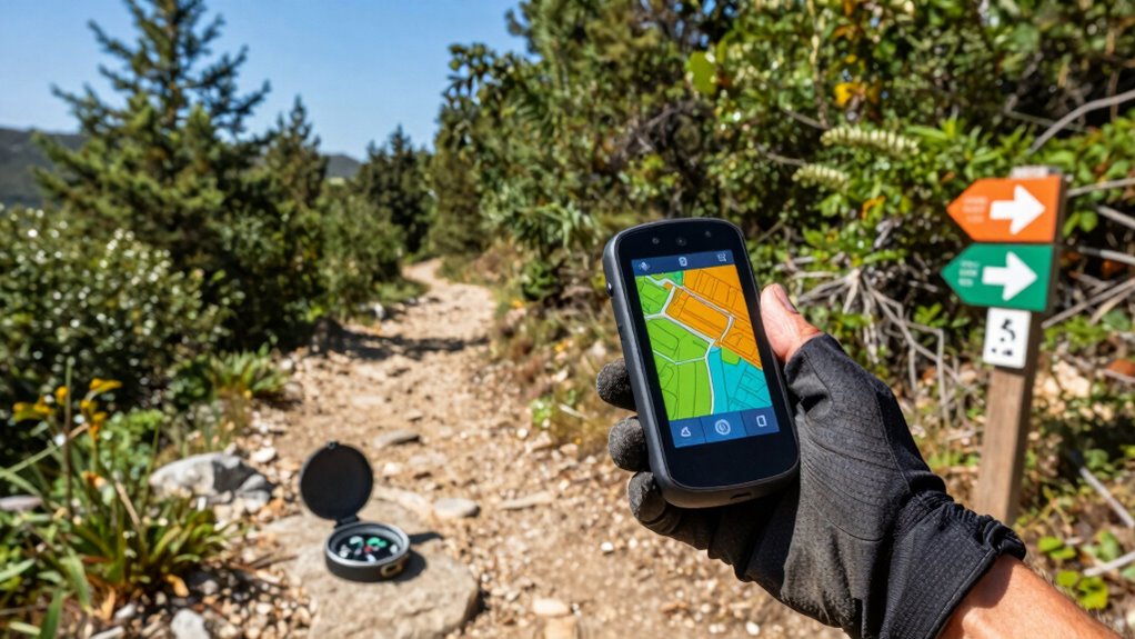

A handheld GPS device for trail running can add route guidance and a navigation backup, but it is bulkier to carry than a running watch or phone. My best overall pick is the Garmin eTrex 22x, which balances mapping and straightforward operation; the GPSMAP 65 is a standout for challenging terrain, while the GPSMAP 66i adds satellite communication for remote routes. The main tradeoffs are mapping detail, signal reception, battery needs, and carry weight. A simpler unit may suit familiar trails, while complex routes can justify more features. Read on for how all 11 options compare and which type of runner each one suits.

Get workout gear delivered free with Prime
- Fast, free delivery on millions of items
- Prime Video, Amazon Music and more included
- Member-only deals all year
Complete the kit


Key Takeaways
- The eTrex 22x is the most balanced choice in this lineup: it adds usable mapping without the communication features and added complexity of the GPSMAP 66i.
- The GPSMAP 65 prioritizes reception over simplicity: its multi-band technology is the distinguishing reason to favor it for difficult terrain, rather than for runners seeking the lightest setup.
- The GPSMAP 66i serves a different need from a standard navigator: satellite communication can matter on remote outings, but adds bulk and features many runners may not need.
- The eTrex 10 and eTrex H are basic navigation picks: they make more sense for recording or following simple tracks than for runners who want detailed map guidance.
- The two eTrex 22x listings are the same named model: compare exact listing details before choosing; the roundup does not treat the duplicate as a separate capability tier.
| Garmin eTrex H Handheld GPS Navigator |  | Best for Bare-Bones Waypoint Navigation | Screen size: 2.37 inches | Resolution: 800 x 480 | Weight: 150 g | VIEW ON AMAZON | See Our Full Breakdown |
| Garmin eTrex SE Handheld GPS Navigator |  | Best for Long-Distance Battery Endurance | Display: 2.2-inch sunlight-readable display, 480 x 272 | Battery life: Up to 168 hours standard mode; up to 1,800 hours expedition mode | Battery type: 2 AA batteries | VIEW ON AMAZON | See Our Full Breakdown |
| Garmin eTrex 10 Worldwide Handheld GPS Navigator |  | Best Simple Entry-Level Pick | Display: 2.2-inch monochrome | Power: Two AA batteries | Battery life: Up to 20 hours | VIEW ON AMAZON | See Our Full Breakdown |
| Garmin eTrex 22x Rugged Handheld GPS |  | Best for On-Device Trail Maps | Display: 2.2-inch sunlight-readable color display, 240 x 320 pixels | Preloaded maps: TopoActive maps with routable roads and trails | Internal memory: 8 GB | VIEW ON AMAZON | See Our Full Breakdown |
| NiesahYan Handheld GPS Navigator for Hiking |  | Best Large-Screen USB-C Pick | Screen size: 3.2 inches | Display type: Sunlight-readable LCD, non-touchscreen | Battery life: Up to 36 hours | VIEW ON AMAZON | See Our Full Breakdown |
| Garmin GPSMAP 66i Handheld GPS and Satellite Communicator |  | Best for Remote-Safety Backup | Display: 3-inch sunlight-readable color display | Maps: Preloaded Garmin TOPO maps; Birdseye satellite imagery downloads | Satellite communication: inReach technology on the Iridium satellite network | VIEW ON AMAZON | See Our Full Breakdown |
| NiesahYan A6 Handheld GPS Navigator for Hiking |  | Best for Map-Free Track Recording | Screen: 2.4-inch sunlight-readable color LCD | Satellite systems: GPS, Galileo, BeiDou, and QZSS | Battery life: Up to 20 hours | VIEW ON AMAZON | See Our Full Breakdown |
| Garmin eTrex 32x Rugged Handheld GPS Navigator |  | Best Value for On-Device Trail Maps | Display: 2.2-inch color TFT, 240 × 320 pixels | Maps: Preloaded TopoActive maps with routable roads and trails | Satellite systems: GPS and GLONASS | VIEW ON AMAZON | See Our Full Breakdown |
| Garmin eTrex Touch GPS Handheld Navigator |  | Best for Long-Distance Battery Life | Screen: 3-inch sunlight-readable capacitive touchscreen | Battery life: Up to 130 hours in typical use; up to 650 hours in Expedition mode | Weight: 5.3 ounces | VIEW ON AMAZON | See Our Full Breakdown |
| Garmin GPSMAP 65 Handheld GPS with Multi-Band Technology |  | Best for Challenging GPS Reception | Display: 2.6-inch color LCD, 160 × 240 pixels | Satellite support: Expanded GNSS with multi-band technology | Maps: TopoActive maps and U.S. public land boundaries | VIEW ON AMAZON | See Our Full Breakdown |
| Garmin eTrex 22x Rugged Handheld GPS Navigator |  | Best for Runners Who Want Preloaded Trail Maps | Display: 2.2-inch color TFT, 240 x 320 resolution | Maps: Preloaded TopoActive topographic maps with routable roads and trails | Satellite systems: GPS and GLONASS | VIEW ON AMAZON | See Our Full Breakdown |
| handheld gps device for trail running | Battery life | Display | Connectivity | Satellite systems |
|---|---|---|---|---|
| Garmin eTrex H Handheld GPS Na | Up to 17 hours on AA batteries | — | Serial | — |
| Garmin eTrex SE Handheld GPS N | Up to 168 hours standard mode; up to 1,800 hours expedition mode | 2.2-inch sunlight-readable display, 480 x 272 | Bluetooth, USB | GPS, GLONASS, Galileo, BeiDou, QZSS |
| Garmin eTrex 10 Worldwide Hand | Up to 20 hours | 2.2-inch monochrome | — | — |
| Garmin eTrex 22x Rugged Handhe | Up to 25 hours in GPS mode | 2.2-inch sunlight-readable color display, 240 x 320 pixels | — | — |
| NiesahYan Handheld GPS Navigat | Up to 36 hours | — | USB-C | GPS, Galileo, BeiDou, QZSS |
| Garmin GPSMAP 66i Handheld GPS | Up to 35 hours in tracking mode; up to 200 hours in Expedition mode | 3-inch sunlight-readable color display | Cellular and GNSS support | — |
| NiesahYan A6 Handheld GPS Navi | Up to 20 hours | — | — | GPS, Galileo, BeiDou, and QZSS |
| Garmin eTrex 32x Rugged Handhe | Up to 25 hours in GPS mode | 2.2-inch color TFT, 240 × 320 pixels | — | GPS and GLONASS |
| Garmin eTrex Touch GPS Handhel | Up to 130 hours in typical use; up to 650 hours in Expedition mode | — | Bluetooth and USB-C | GPS, GLONASS, and Galileo with multi-band support |
| Garmin GPSMAP 65 Handheld GPS | Up to 16 hours | 2.6-inch color LCD, 160 × 240 pixels | Bluetooth and ANT+ | — |
| Garmin eTrex 22x Rugged Handhe | Up to 25 hours | 2.2-inch color TFT, 240 x 320 resolution | — | GPS and GLONASS |
More Details on Our Top Picks
Garmin eTrex H Handheld GPS Navigator
The eTrex H is a basic, lightweight option for trail runners who want to mark and return to locations without carrying a phone-dependent navigation setup. Its 500-waypoint capacity and support for 20 routes offer more saved points than the eTrex 10’s product data specifies, while IPX7 protection suits wet-weather outings. Up to 17 hours from AA batteries is useful, though it falls short of the eTrex 10’s stated 20 hours and the eTrex 22x’s 25. The tradeoff is a small, low-resolution display and limited connectivity: its serial connection is less convenient than the eTrex SE’s Bluetooth and USB. I’d choose it for simple point-to-point use, not for reading detailed trail maps while moving.
Pros:- Stores up to 500 waypoints and 20 routes
- IPX7-rated housing handles rain and brief submersion
- Up to 17 hours of operation on AA batteries
- High-sensitivity, WAAS-enabled receiver
Cons:- Small, low-resolution screen can make map details hard to read
- Serial connectivity is less convenient than the eTrex SE’s Bluetooth and USB
- Uses AA batteries only; batteries are not included
Best for: Trail runners who want a simple, rugged device for saving waypoints and routes and prefer replaceable AA batteries.
Not ideal for: Runners who need an easy-to-read map screen, modern phone connectivity, or rechargeable power.
- Screen size:2.37 inches
- Resolution:800 x 480
- Weight:150 g
- Dimensions:2.0 x 4.4 x 1.2 inches (W x H x D)
- Battery life:Up to 17 hours on AA batteries
- Waypoint capacity:500 waypoints
- Route capacity:20 routes, up to 125 waypoints each
- Connectivity:Serial
Our verdict“Choose the eTrex H for straightforward waypoint tracking, but pick the eTrex 22x or eTrex SE if screen readability or newer connectivity matters more.”
Garmin eTrex SE Handheld GPS Navigator
For long trail days where charging opportunities are scarce, the eTrex SE has the strongest stated battery-life case here: up to 168 hours in standard mode or 1,800 hours in expedition mode on two AA batteries. Its sunlight-readable screen and multi-GNSS support make it a more practical running companion than the monochrome eTrex 10, while the digital compass works when stationary—handy when checking direction at a junction without moving. Bluetooth and USB also add phone-app planning and update options that the eTrex H lacks. The compromises are limited internal storage and reliance on a compatible smartphone for some app features. Like the eTrex 22x, it has a 2.2-inch display, so it is not the pick for runners who want a larger map view.
Pros:- Up to 168 hours in standard mode and 1,800 hours in expedition mode
- Sunlight-readable 2.2-inch display
- Supports GPS, GLONASS, Galileo, BeiDou, and QZSS
- Digital compass functions while stationary
Cons:- Two AA batteries are not included
- Some app features require a compatible smartphone
- 28 MB of stated storage limits room for stored data
Best for: Ultrarunners and remote-trail runners who prioritize long battery life, replaceable AA cells, and multi-GNSS positioning.
Not ideal for: Runners who want detailed preloaded trail maps on a larger display or prefer a device that does not depend on a phone for app features.
- Display:2.2-inch sunlight-readable display, 480 x 272
- Battery life:Up to 168 hours standard mode; up to 1,800 hours expedition mode
- Battery type:2 AA batteries
- Satellite systems:GPS, GLONASS, Galileo, BeiDou, QZSS
- Water resistance:IPX7
- Connectivity:Bluetooth, USB
- Storage capacity:28 MB
- Weight:5.5 ounces
Our verdict“Pick the eTrex SE for exceptional stated battery endurance and multi-GNSS support, and choose the eTrex 22x instead if preloaded topo maps matter more.”
Garmin eTrex 10 Worldwide Handheld GPS Navigator
The eTrex 10 suits runners who want basic location guidance without paying for a color mapping interface they may not need. Its preloaded worldwide basemap, WAAS and GLONASS support, and paperless geocaching give it a little more navigation context than the waypoint-focused eTrex H. Battery life is listed at up to 20 hours on two AA batteries, ahead of the eTrex H’s 17 hours, though it trails the eTrex 22x’s 25. The monochrome 2.2-inch display keeps the feature set simple, but it also makes detailed trail interpretation less convenient than on the eTrex 22x’s color screen. I’d treat the basemap as basic orientation rather than a substitute for richer topo mapping.
Pros:- Preloaded worldwide basemap for basic location context
- Up to 20 hours on two AA batteries
- WAAS and GLONASS support
- IPX7 waterproof design
Cons:- Monochrome display is less legible for map detail than the eTrex 22x’s color screen
- Mapping features are basic compared with models with preloaded topo maps
- Requires replaceable AA batteries
Best for: New handheld-GPS users who want a rugged device for basic position checks, saved locations, and simple route guidance.
Not ideal for: Trail runners who need detailed topo maps, a color display, or a large screen for reading junctions at a glance.
- Display:2.2-inch monochrome
- Power:Two AA batteries
- Battery life:Up to 20 hours
- Navigation:Preloaded worldwide basemap, WAAS, GLONASS
- Geocaching:Paperless geocaching support
- Mounting:Garmin spine mounting
Our verdict“Choose the eTrex 10 for straightforward, rugged navigation, but step up to the eTrex 22x if you need readable color topo maps on the trail.”
Garmin eTrex 22x Rugged Handheld GPS
The eTrex 22x is the clearest fit for runners who want to follow mapped trails directly on a handheld. Its sunlight-readable color display and preloaded TopoActive maps with routable roads and trails give more useful route context than the eTrex 10’s basic worldwide basemap or the eTrex SE’s stated 28 MB of storage. Up to 25 hours of GPS-mode battery life on two AA batteries also supports long outings without requiring a rechargeable setup. The tradeoff is screen size: at 2.2 inches, it still requires close attention for map details, especially while moving. It also lacks the eTrex SE’s listed multi-GNSS range and digital compass. I’d favor it when map readability and preloaded trail data outrank those extras.
Pros:- Preloaded TopoActive maps include routable roads and trails
- Sunlight-readable color display
- Up to 25 hours of GPS-mode battery life
- 8 GB of internal memory
Cons:- 2.2-inch display can feel cramped for detailed map checks
- Uses two AA batteries rather than built-in USB-C charging
- Does not list the eTrex SE’s multi-GNSS support or digital compass
Best for: Trail runners who want preloaded topo maps and a color display for checking routes away from phone coverage.
Not ideal for: Runners who prioritize a larger screen, USB-C rechargeable power, or the eTrex SE’s multi-GNSS and stationary-compass features.
- Display:2.2-inch sunlight-readable color display, 240 x 320 pixels
- Preloaded maps:TopoActive maps with routable roads and trails
- Internal memory:8 GB
- Battery life:Up to 25 hours in GPS mode
- Battery type:2 AA batteries
- Included accessories:USB adapter cube, 2-port USB car adapter, microfiber cleaning cloth
Our verdict“Choose the eTrex 22x if preloaded color topo maps are your priority; choose the eTrex SE for longer stated battery life and broader satellite-system support.”
NiesahYan Handheld GPS Navigator for Hiking
The NiesahYan Handheld GPS Navigator stands apart from the Garmin eTrex models with its 3.2-inch sunlight-readable screen and USB-C charging. That larger display should make map checks easier than on the eTrex 22x’s 2.2-inch screen, while the stated 36-hour battery life avoids the need to carry spare AA cells. It also pairs multi-GNSS support with a 3-axis compass, barometric altimeter, and preloaded USA Topo maps, giving runners several navigation cues in one device. The tradeoff is uncertainty around software update support, and its listed IP66 rating is different from the IPX7 ratings specified for several Garmin options. I’d choose it for screen size and rechargeable convenience, but favor a Garmin if its established app and update path matters more.
Pros:- 3.2-inch sunlight-readable display is larger than the eTrex 22x’s
- Up to 36 hours of battery life with USB-C charging
- Supports GPS, Galileo, BeiDou, and QZSS
- Includes USA Topo maps, a 3-axis compass, and a barometric altimeter
Cons:- Software update support status is unspecified
- IP66 rating differs from the IPX7 rating listed for the eTrex SE and eTrex 22x
- Non-touchscreen controls may feel slower for users accustomed to touch navigation
Best for: Trail runners who want a larger map display, USB-C charging, and built-in compass and altitude sensors in one handheld.
Not ideal for: Runners who need clearly documented software-update support or prefer the replaceable AA batteries and IPX7 rating found on Garmin alternatives.
- Screen size:3.2 inches
- Display type:Sunlight-readable LCD, non-touchscreen
- Battery life:Up to 36 hours
- Storage capacity:32 GB
- Satellite systems:GPS, Galileo, BeiDou, QZSS
- Connectivity:USB-C
- Preloaded maps:USA Topo
- Sensors:3-axis compass, barometric altimeter
- Water resistance:IP66
Our verdict“Choose the NiesahYan for a larger screen and USB-C power, but favor the eTrex 22x if Garmin’s stated IPX7 protection and trail-mapping setup suit you better.”
Garmin GPSMAP 66i Handheld GPS and Satellite Communicator
The GPSMAP 66i is the strongest fit here for runners whose routes take them beyond reliable cell coverage and who want satellite messaging alongside navigation. Its inReach SOS and two-way messaging add a safety option the eTrex 32x and GPSMAP 65 do not provide, while the 3-inch sunlight-readable screen gives maps more room than those smaller-display models. Preloaded topographic maps and downloadable satellite imagery also help with route planning away from marked trails. The tradeoff is extra commitment: messaging requires a satellite subscription, and the larger feature set may be more than a runner needs for familiar local routes. Its stated 35-hour tracking battery life is useful, but the eTrex Touch lists much longer typical-use endurance. I’d choose this for remote outings where communication matters more than minimizing gear.
Pros:- inReach satellite SOS and two-way messaging provide communication beyond cell coverage
- 3-inch sunlight-readable color display offers more map viewing area than the eTrex 32x
- Preloaded topographic maps and downloadable Birdseye satellite imagery support off-trail planning
- Up to 200 hours in Expedition mode
Cons:- Satellite messaging features require a subscription
- Up to 35 hours in tracking mode is less than the eTrex Touch’s stated typical-use battery life
- Satellite communication devices may face legal restrictions in some areas
Best for: Trail runners who regularly enter remote areas without cell coverage and want satellite SOS and messaging with their handheld navigation device.
Not ideal for: Runners on familiar, well-covered trails who want a simple navigation device without a satellite-service subscription or extra communication features.
- Display:3-inch sunlight-readable color display
- Maps:Preloaded Garmin TOPO maps; Birdseye satellite imagery downloads
- Satellite communication:inReach technology on the Iridium satellite network
- Battery life:Up to 35 hours in tracking mode; up to 200 hours in Expedition mode
- Connectivity:Cellular and GNSS support
- Navigation features:Satellite communication, weather updates, and GPS navigation
Our verdict“Choose the GPSMAP 66i if satellite communication is a priority on remote trail runs; skip it if you only need basic route guidance.”
NiesahYan A6 Handheld GPS Navigator for Hiking
The NiesahYan A6 suits runners who mainly want to record a route, mark waypoints, and check basic outdoor readings rather than follow detailed maps. Its four satellite systems—GPS, Galileo, BeiDou, and QZSS—offer more listed system coverage than the GPS and GLONASS combination on the eTrex 32x. It also adds a compass and barometric altimeter in a compact handheld format. The key limitation is plain: maps are not included, so this is a weaker choice for unfamiliar trails where seeing terrain and route options matters. Compared with the mapped Garmin eTrex 32x, the A6 asks the runner to rely more on recorded tracks and waypoints than on on-device cartography. Its 20-hour battery life is workable for many outings, though below the eTrex 32x’s stated 25 hours.
Pros:- Supports GPS, Galileo, BeiDou, and QZSS satellite systems
- Records tracks and waypoints for route logging and return navigation
- Includes a compass, barometric altimeter, and sunrise and sunset information
- USB-C charging and up to 20 hours of battery life
Cons:- Maps are not included, limiting guidance on unfamiliar trails
- Up to 20 hours of battery life is shorter than the eTrex 32x’s stated 25 hours
- Satellite signal acquisition requires an open sky
Best for: Runners who want to record and revisit known routes, mark waypoints, and use a compass or altimeter without needing maps on the device.
Not ideal for: Runners exploring unfamiliar or poorly marked trails who need on-device maps to check route choices and terrain.
- Screen:2.4-inch sunlight-readable color LCD
- Satellite systems:GPS, Galileo, BeiDou, and QZSS
- Battery life:Up to 20 hours
- Charging:USB-C
- Navigation features:Track recording, track navigation, waypoints, compass, barometric altimeter, sunrise and sunset
- Maps:Not included
- Dimensions:6.1 × 0.9 × 2.1 inches
- Warranty:2 years
Our verdict“Pick the A6 for basic track recording and outdoor readings on familiar routes, not for map-led navigation on new trails.”
Garmin eTrex 32x Rugged Handheld GPS Navigator
The eTrex 32x is a practical choice for runners who want preloaded routable trail maps without moving up to a larger touchscreen device. Its small 2.2-inch display keeps the unit compact, but map labels and route details will take more attention to read than on the GPSMAP 66i or eTrex Touch. The built-in 3-axis compass and barometric altimeter add useful orientation and elevation context, while two AA batteries make it possible to carry spares instead of relying only on a rechargeable battery. Compared with the NiesahYan A6, the 32x includes maps; compared with the GPSMAP 65, it offers longer stated battery life but lists only GPS and GLONASS rather than multi-band satellite support. Its older, smaller screen is the main compromise for quick checks while moving.
Pros:- Preloaded TopoActive maps include routable roads and trails
- 3-axis compass and barometric altimeter provide orientation and elevation information
- Up to 25 hours of GPS battery life using two AA batteries
- 8 GB of internal storage plus a microSD card slot
Cons:- 2.2-inch display is small for reading maps while moving
- Supports GPS and GLONASS, but the listed satellite systems do not include multi-band support
- Uses two AA batteries rather than a built-in rechargeable battery
Best for: Trail runners who want a compact Garmin with routable maps, an altimeter, and replaceable AA batteries for day outings.
Not ideal for: Runners who prioritize a large, quick-to-read display or multi-band positioning for difficult reception conditions.
- Display:2.2-inch color TFT, 240 × 320 pixels
- Maps:Preloaded TopoActive maps with routable roads and trails
- Satellite systems:GPS and GLONASS
- Sensors:3-axis compass and barometric altimeter
- Storage:8 GB internal storage; microSD card slot
- Battery life:Up to 25 hours in GPS mode
- Batteries:2 AA
- Weight:4.96 ounces
Our verdict“Choose the eTrex 32x if compact mapped navigation and swappable batteries matter more than a larger screen or multi-band reception.”
Garmin eTrex Touch GPS Handheld Navigator
For runners who may spend several days out and want to check maps on a larger screen, the eTrex Touch leads this group on stated endurance: up to 130 hours in typical use and 650 hours in Expedition mode. Its bright 3-inch touchscreen is more readable for map checks than the eTrex 32x’s 2.2-inch display, and multi-band GPS support adds a positioning advantage over that model’s listed GPS and GLONASS support. It is also rated IP67 and weighs 5.3 ounces. The tradeoffs are that its premium map content requires a separate Outdoor Maps+ subscription, and a touchscreen may not suit every runner’s preference for simple physical controls. Compared with the button-operated GPSMAP 65, this is the better fit for screen size and battery life, but not for those who want button-only operation.
Pros:- Up to 130 hours of typical-use battery life and up to 650 hours in Expedition mode
- 3-inch sunlight-readable capacitive touchscreen
- Multi-band support across GPS, GLONASS, and Galileo
- IP67 water rating and 32 GB of storage
Cons:- Premium map content requires a separate Outdoor Maps+ subscription
- Touchscreen controls may be less appealing to runners who prefer the GPSMAP 65’s buttons
- Additional accessories are sold separately
Best for: Trail runners planning long outings who want a large touchscreen, multi-band positioning, and extended stated battery life in a water-rated device.
Not ideal for: Runners who prefer button controls or want premium map content without a separate Outdoor Maps+ subscription.
- Screen:3-inch sunlight-readable capacitive touchscreen
- Battery life:Up to 130 hours in typical use; up to 650 hours in Expedition mode
- Weight:5.3 ounces
- Storage:32 GB
- Connectivity:Bluetooth and USB-C
- Satellite systems:GPS, GLONASS, and Galileo with multi-band support
- Map coverage:North America
Our verdict“Choose the eTrex Touch for long outings that call for a large touchscreen and extended battery life, provided its map subscription and touch controls suit you.”
Garmin GPSMAP 65 Handheld GPS with Multi-Band Technology
The GPSMAP 65 is the choice for trail runners who value positional accuracy in places where terrain or tree cover can make a signal less dependable. Its expanded GNSS and multi-band technology set it apart from the eTrex 32x, which lists GPS and GLONASS without multi-band support. The included TopoActive maps and U.S. public land boundaries also help runners check route context and land access. In return, you get a 2.6-inch, button-operated screen and a stated battery life of up to 16 hours—less endurance than the eTrex 32x’s 25 hours and far below the eTrex Touch’s 130-hour typical-use figure. That makes the GPSMAP 65 better suited to accuracy-focused day routes than long outings where battery life is the priority. Garmin Explore route management also requires a compatible smartphone.
Pros:- Expanded GNSS and multi-band technology support positioning in challenging terrain
- TopoActive maps include U.S. public land boundaries
- Button controls offer a physical alternative to the eTrex Touch touchscreen
- Bluetooth and ANT+ connectivity support Garmin Explore features
Cons:- Up to 16 hours of battery life is below the eTrex 32x’s stated 25 hours
- 2.6-inch screen has less viewing area than the 3-inch eTrex Touch
- Garmin Explore app use requires a compatible smartphone
Best for: Runners on steep, wooded, or otherwise challenging routes who want multi-band positioning, physical buttons, and U.S. public land boundary maps.
Not ideal for: Runners prioritizing long battery life or a large touchscreen for map reading, especially on extended outings.
- Display:2.6-inch color LCD, 160 × 240 pixels
- Satellite support:Expanded GNSS with multi-band technology
- Maps:TopoActive maps and U.S. public land boundaries
- Connectivity:Bluetooth and ANT+
- Battery life:Up to 16 hours
- Controls:Buttons
- Included items:GPSMAP 65, USB cable, carabiner clip, and documentation
- Warranty:1-year limited warranty
Our verdict“Pick the GPSMAP 65 when multi-band reception and button controls matter more than long battery life or a larger screen.”
Garmin eTrex 22x Rugged Handheld GPS Navigator
The Garmin eTrex 22x is a practical pick for trail runners who want a handheld backup with preloaded routable topographic maps, rather than a bare position readout. Its color screen is designed to remain readable in sunlight, and support for GPS and GLONASS can help maintain tracking in challenging surroundings. Compared with the simpler Garmin eTrex 10, the 22x adds mapped route context; it also offers less advanced positioning features than the Garmin GPSMAP 65. The up-to-25-hour runtime and replaceable AA batteries suit long outings where recharging may not be convenient. The tradeoff is its small, non-touch display: it is better for checking location and routes than for quick, detailed map interaction while moving. At 4.96 ounces, it is still extra gear to carry on a run.
Pros:- Preloaded routable topographic maps provide trail and road context without requiring an initial map purchase
- Sunlight-readable color display helps with quick checks on exposed routes
- GPS and GLONASS support can aid tracking in challenging environments
- Runs for up to 25 hours on replaceable AA batteries
Cons:- Small, non-touch display makes detailed map interaction slower than on touchscreen models
- Two AA batteries add carrying and replacement needs compared with rechargeable devices
Best for: Trail runners who want a rugged handheld for route backup, readable maps, and long outings without relying on a rechargeable battery
Not ideal for: Runners who prioritize a light, wrist-worn setup or need a touchscreen and advanced multi-band positioning for detailed navigation
- Display:2.2-inch color TFT, 240 x 320 resolution
- Maps:Preloaded TopoActive topographic maps with routable roads and trails
- Satellite systems:GPS and GLONASS
- Internal storage:8 GB
- Expandable storage:microSD card slot
- Battery life:Up to 25 hours
- Battery type:2 AA batteries
- Weight:4.96 ounces
- Dimensions:4 x 8 x 1.3 inches
Our verdict“Choose the eTrex 22x if you want mapped trail context and long AA-powered runtime in a rugged handheld, and skip it if low carry weight or advanced positioning matters more.”

How We Picked
I ranked these devices around trail-running needs rather than general hiking use: dependable position information, route-following usefulness, clear operation on the move, practical carry and battery demands, and the level of navigation support provided. A handheld can be a useful backup, but bulk, screen interaction, and the need to manage power matter more when running than they do on a slow walk.
The order favors devices that offer a useful balance of navigation and usability for a broad range of trail runners. Models with detailed mapping or stronger reception capabilities move up when those features solve a real route problem; satellite communication earns its place for remote outings, not as a default benefit. Simpler and less capable units sit lower for runners who need maps, while products with limited confirmed detail are not credited with unverified advantages. The eTrex 22x appears twice in the supplied lineup, so I treat those entries as a duplicate rather than inventing a distinction.
| handheld gps device for trail running | Connectivity | Satellite systems |
|---|---|---|
| Garmin eTrex H Handheld GPS Na | Serial | — |
| Garmin eTrex SE Handheld GPS N | Bluetooth, USB | GPS, GLONASS, Galileo, BeiDou, QZSS |
| Garmin eTrex 10 Worldwide Hand | — | — |
| Garmin eTrex 22x Rugged Handhe | — | — |
| NiesahYan Handheld GPS Navigat | USB-C | GPS, Galileo, BeiDou, QZSS |
| Garmin GPSMAP 66i Handheld GPS | Cellular and GNSS support | — |
| NiesahYan A6 Handheld GPS Navi | — | GPS, Galileo, BeiDou, and QZSS |
| Garmin eTrex 32x Rugged Handhe | — | GPS and GLONASS |
| Garmin eTrex Touch GPS Handhel | Bluetooth and USB-C | GPS, GLONASS, and Galileo with multi-band support |
| Garmin GPSMAP 65 Handheld GPS | Bluetooth and ANT+ | — |
| Garmin eTrex 22x Rugged Handhe | — | GPS and GLONASS |
Factors to Consider When Choosing Handheld Gps Device For Trail Running
For trail running, the right handheld is the one you can carry and operate when a route gets confusing—not simply the one with the longest feature list. I would decide how often you need maps, how demanding your terrain is, and whether the device is a backup or your main navigation tool before comparing models.
Decide Whether You Need Maps or Just a Track
A recorded track and a detailed map solve different problems. A track can help you follow a route you already planned, but it offers less context when a junction is unmarked or you need to reroute. Map support can make nearby trails and terrain easier to interpret, though a small handheld screen is not a substitute for studying the route beforehand. A common mistake is buying a basic navigator and expecting it to show rich trail detail. If you regularly explore unfamiliar networks, prioritize mapping; for repeat routes, simpler guidance may be enough.
Match Reception to the Terrain You Run
Open ridgelines and tree-covered valleys put different demands on positioning. Multi-band reception, as found on the GPSMAP 65, is most relevant when terrain or canopy makes a stable position harder to maintain; it is less compelling if most runs follow open, familiar paths. Do not assume that a reception upgrade can replace route planning or map visibility. Consider where you actually run, including canyon walls, dense forest, and steep slopes. If those conditions are rare, a more straightforward device may be easier to carry and use.
Plan How You Will Carry and Operate It
A handheld that works well on a hike may feel awkward while running, especially if it needs two hands or repeated screen checks. Before buying, think about a secure vest pocket, an accessible belt pouch, or another way to stop the device bouncing and getting in the way. Larger displays can aid map reading, but can also add to the device’s footprint. Button controls can be easier to use with wet hands than a touchscreen, while touch operation may feel more direct when stopped. Choose for the way you intend to carry it, not just for what looks convenient indoors.
Treat Battery Life as a Route-Planning Constraint
Battery life depends on settings, satellite use, screen activity, temperature, and the length of the outing, so headline claims do not tell the whole story. Check what power source the exact model uses and whether you can carry spares or recharge it during a long day. Mapping and frequent screen checks can raise power demands compared with recording a simple track. A common error is starting a long run with a nearly depleted unit because the previous outing was short. Build a margin for delays, detours, and colder conditions rather than planning around the shortest expected time.
Choose Communication Features for the Risk, Not the Spec Sheet
Satellite communication is a separate safety capability from GPS navigation. The GPSMAP 66i combines a handheld navigator with satellite communication, which can suit remote routes where mobile coverage is unreliable and contacting others matters. That does not make it necessary for every trail runner, and communication features can bring extra setup, carry weight, and service considerations. Check coverage, subscription requirements, and how messaging or emergency functions work before relying on them. For routes close to roads and regular coverage, a simpler navigator plus a clear check-in plan may be a better fit.
Confirm Maps, Controls, and Model Details Before Buying
Names within a product family can be similar while capabilities differ, so confirm the exact model and included map coverage in the listing and manufacturer documentation. The supplied lineup includes the eTrex 22x twice, a reminder to check model numbers rather than assume two listings offer different hardware. Also check whether the unit’s control style suits your gloves, weather, and need to make quick adjustments. Do not count on a map being detailed for your local trails just because a device supports maps. Verify the area you plan to run and the process for adding or updating mapping before committing.
Frequently Asked Questions
Is a handheld GPS a better choice than a running watch for trail navigation?
It depends on whether you value a dedicated map display or a low-profile setup. A watch is easier to wear while running and can be checked with little fuss, while a handheld may offer a more practical map view and dedicated navigation controls. Carrying a handheld takes planning, and it can be uncomfortable if it bounces or occupies a hand. Many runners use a watch for routine tracking and carry a handheld only when the route is unfamiliar or remote. Compare the navigation features you will actually use, not just the device category.
Can the eTrex 10 or eTrex H guide me on an unfamiliar trail?
They may help with basic positioning and track-based navigation, but they are not the strongest choices for runners who need detailed map context. Without the mapping capabilities of options such as the eTrex 22x, it can be harder to interpret nearby trail choices or change plans at a junction. These simpler models make more sense when you have a route prepared and mainly want a navigation aid. For unfamiliar trail networks, check exactly what route and map information the device can display before relying on it. Carrying a paper or offline phone map as a backup can help.
Is the GPSMAP 65 worth choosing if I usually run in forest or canyons?
The GPSMAP 65’s multi-band technology makes it the clearest fit in this group when challenging terrain is a regular part of your routes. Better reception can support more dependable positioning in places where signal conditions are difficult, but it does not guarantee perfect tracking in every situation. If most of your running is on open, familiar trails, the added capability may matter less than simpler operation or a more manageable carry. Think about your most demanding regular route, not just an occasional worst-case outing. Map availability and route planning still matter even with stronger reception.
When does satellite messaging justify the GPSMAP 66i?
The GPSMAP 66i is most compelling when you run beyond reliable mobile coverage and want a way to communicate by satellite, not merely record your position. Before choosing it, check current service and subscription requirements, coverage where you run, and how the emergency and messaging functions operate. Those features add value only if you are prepared to set them up and carry the device. For short routes near populated areas, the extra communication capability may be unnecessary. A less specialized navigator can be a better match when route guidance is the main need.
What should I check when two listings show the eTrex 22x?
The lineup contains two entries with the same Garmin eTrex 22x name, so I would not assume they are distinct models. Compare the exact model number, included accessories, map coverage, condition, and seller-provided specifications. Check the manufacturer’s current documentation if a listing claims a feature that does not match the model name. Do not treat duplicate entries as evidence of a separate version or extra capability. If the details match, make your choice based on the listing’s terms and what is actually included.
Conclusion
For most runners who want a balance of route guidance and mapping, I would start with the Garmin eTrex 22x as best overall. The Garmin eTrex 10 is my best value-style choice for basic track use, though runners who need maps should move up rather than expect it to do more than it can. For a premium, feature-rich option, choose the GPSMAP 66i when satellite communication is part of the plan; choose the GPSMAP 65 instead when difficult reception conditions matter more. Beginners with familiar routes may find the eTrex 10 easier to approach, while runners who need a simple basic navigator can also compare the eTrex H. For remote outings, the 66i is the specific pick; for forested or rugged terrain, the GPSMAP 65 is the better match. The two eTrex 22x entries are duplicate listings, so verify the exact listing details rather than treating them as separate models.
Evergreen bestsellers Picks
bestsellers
As an affiliate, we earn on qualifying purchases.