
When it comes to planning outdoor adventures, having reliable trail maps is essential. The Yellowstone and Grand Teton National Parks Map Pack stands out as the best overall for its comprehensive coverage and durability. For those focusing on specific regions, the Acadia National Park Map offers detailed local insights, while the John Muir Trail Topographic Map Guide is perfect for serious hikers seeking precision. The main tradeoffs in this category often involve balancing detail versus portability and choosing between regional and national coverage. Continue reading for a detailed breakdown of these top picks and what makes each one unique.

Get workout gear delivered free with Prime
- Fast, free delivery on millions of items
- Prime Video, Amazon Music and more included
- Member-only deals all year
Complete the kit



Key Takeaways
- The most comprehensive maps tend to be bulkier but are invaluable for multi-day trips or extensive exploration.
- Topographic detail varies significantly; choose based on whether you need elevation info or simple navigation cues.
- Bundle packs often provide better value for multiple parks, but single-region maps can offer more detail and clarity.
- Durability and waterproofing are critical for outdoor use, especially in variable weather conditions.
- The best maps balance scale, detail, and portability according to the specific adventure or terrain.
| Yellowstone and Grand Teton National Parks Map Pack Bundle (National Geographic Trails Illustrated Map) |  | Best for Comprehensive Park Exploration | Coverage Area: Yellowstone and Grand Teton National Parks | Produced By: National Geographic Trails Illustrated | Map Type: Detailed topographic | VIEW ON AMAZON | See Our Full Breakdown |
| Acadia National Park Map (National Geographic Trails Illustrated Map, 212) | 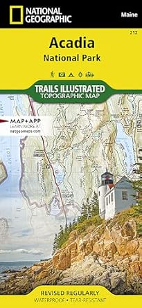 | Best for Day Hikers and Campers in Acadia | Coverage Area: Acadia National Park | Material: Waterproof paper | Map Type: Trail and topographical | VIEW ON AMAZON | See Our Full Breakdown |
| John Muir Trail Topographic Map Guide (National Geographic Topographic Map Guide) |  | Best for Trail-Specific Navigation and Planning | Coverage Area: John Muir Trail | Map Type: Topographic | Material: Durable, portable paper | VIEW ON AMAZON | See Our Full Breakdown |
| Canyonlands National Park Map Pack Bundle (National Geographic Trails Illustrated Map) |  | Best for Multi-Activity Park Exploration | Coverage Area: Canyonlands National Park | Material: Waterproof paper | Map Type: Trail and topographical | VIEW ON AMAZON | See Our Full Breakdown |
| Appalachian Trail Planning and Overview Map (National Geographic Trails Illustrated Map, 5501) |  | Best for Trail Planning and Route Overview | Coverage Area: Appalachian Trail | Map Type: Overview and topographical | Material: Durable paper | VIEW ON AMAZON | See Our Full Breakdown |
| Rocky Mountain Day Hikes and National Park Map (National Geographic Trails Illustrated Map) |  | Best for Comprehensive Park Exploration | Coverage Area: Rocky Mountain region | Material: Waterproof, durable paper | Scale: Not specified | VIEW ON AMAZON | See Our Full Breakdown |
| Yosemite Day Hikes and National Park Map (National Geographic Trails Illustrated Map) |  | Best for Yosemite Visitors | Coverage Area: Yosemite National Park | Material: Waterproof paper | Scale: Not specified | VIEW ON AMAZON | See Our Full Breakdown |
| Big Bend Day Hikes and National Park Map (National Geographic Trails Illustrated Map) |  | Best for Desert and Mountain Terrain | Coverage Area: Big Bend National Park | Material: Waterproof paper | Scale: Not specified | VIEW ON AMAZON | See Our Full Breakdown |
| Appalachian Trail: Georgia, North Carolina, Tennessee Map Pack Bundle (National Geographic Trails Illustrated Map) |  | Best for Long-Distance Trail Planning | Coverage Area: Georgia, North Carolina, Tennessee | Material: Waterproof paper | Scale: Not specified | VIEW ON AMAZON | See Our Full Breakdown |
| Canyonlands National Park (National Geographic Trails Illustrated Map) |  | Best for Diverse Terrain Exploration | Coverage Area: Canyonlands National Park | Material: Waterproof paper | Scale: Not specified | VIEW ON AMAZON | See Our Full Breakdown |
| Appalachian Trail: Georgia and North Carolina Map (Springer Mountain to Davenport Gap) |  | Best for Topographic Detail | Coverage Area: Springer Mountain to Davenport Gap | Map Type: Topographic | Scale: Not specified | VIEW ON AMAZON | See Our Full Breakdown |
| Great Smoky Mountains National Park Map (National Geographic Trails Illustrated Map, 229) |  | Best for Trail Details and Durability | Map Scale: Detailed | Material: Waterproof paper | Coverage: Entire park | VIEW ON AMAZON | See Our Full Breakdown |
| Yosemite National Park Map (National Geographic Trails Illustrated Map, 206) |  | Best for In-Depth Park Exploration | Coverage Area: Yosemite National Park | Map Type: Trails Illustrated | Scale: Detailed | VIEW ON AMAZON | See Our Full Breakdown |
| Zion National Park Map (National Geographic Trails Illustrated Map, 214) |  | Best for Topography & Trail Navigation | Coverage Area: Zion National Park | Map Type: Trails Illustrated | Scale: Detailed | VIEW ON AMAZON | See Our Full Breakdown |
| Colorado Trail Map Pack Bundle (National Geographic Trails Illustrated Map) |  | Best for Multi-Map Adventure Planning | Coverage: Entire Colorado Trail | Number of Maps: Multiple | Map Type: Topographic, Trails Illustrated | VIEW ON AMAZON | See Our Full Breakdown |
| trail map | Coverage Area | Material | Map Type | Scale |
|---|---|---|---|---|
| Yellowstone and Grand Teton Na | Yellowstone and Grand Teton National Parks | — | Detailed topographic | — |
| Acadia National Park Map | Acadia National Park | Waterproof paper | Trail and topographical | — |
| John Muir Trail Topographic Ma | John Muir Trail | Durable, portable paper | Topographic | — |
| Canyonlands National Park Map | Canyonlands National Park | Waterproof paper | Trail and topographical | — |
| Appalachian Trail Planning and | Appalachian Trail | Durable paper | Overview and topographical | — |
| Rocky Mountain Day Hikes and N | Rocky Mountain region | Waterproof, durable paper | — | Not specified |
| Yosemite Day Hikes and Nationa | Yosemite National Park | Waterproof paper | — | Not specified |
| Big Bend Day Hikes and Nationa | Big Bend National Park | Waterproof paper | — | Not specified |
| Appalachian Trail: Georgia | Georgia, North Carolina, Tennessee | Waterproof paper | — | Not specified |
| Canyonlands National Park | Canyonlands National Park | Waterproof paper | — | Not specified |
| Appalachian Trail: Georgia and | Springer Mountain to Davenport Gap | — | Topographic | Not specified |
| Great Smoky Mountains National | — | Waterproof paper | — | — |
| Yosemite National Park Map | Yosemite National Park | — | Trails Illustrated | Detailed |
| Zion National Park Map | Zion National Park | — | Trails Illustrated | Detailed |
| Colorado Trail Map Pack Bundle | — | — | Topographic, Trails Illustrated | — |
More Details on Our Top Picks
Yellowstone and Grand Teton National Parks Map Pack Bundle (National Geographic Trails Illustrated Map)
This map bundle stands out for providing detailed coverage of two of America’s most iconic parks—Yellowstone and Grand Teton—making it ideal for visitors who want a one-stop resource. Compared with the Acadia map, which specializes in a single park, this bundle offers broader coverage but lacks specific trail detail for individual parks. While the maps are highly detailed and produced by National Geographic Trails Illustrated, they don’t include features like waterproofing or GPS integration, which could enhance outdoor use. This makes them perfect for planned trips and detailed navigation, but less ideal for on-the-fly GPS-based navigation in remote areas.
Pros:- Comprehensive and accurate maps of Yellowstone and Grand Teton
- Produced by trusted National Geographic Trails Illustrated
- Ideal for detailed navigation and trip planning
Cons:- No waterproof or weather-resistant features specified
- Limited to broad park coverage, lacking trail-specific detail
Best for: Outdoor enthusiasts planning extensive trips to Yellowstone and Grand Teton, needing detailed park-wide maps.
Not ideal for: Casual visitors or day-trippers who prefer simplified maps or GPS apps for quick navigation.
- Coverage Area:Yellowstone and Grand Teton National Parks
- Produced By:National Geographic Trails Illustrated
- Map Type:Detailed topographic
- Durability:No specific waterproof features
- Intended Use:Navigation and trip planning
Our verdict“This map pack is best suited for serious explorers who want detailed, park-wide navigation for Yellowstone and Grand Teton trips.”
Acadia National Park Map (National Geographic Trails Illustrated Map, 212)
This map is tailored for visitors exploring Acadia, with detailed trail and topographical info that makes it a reliable companion for day hikers, campers, and outdoor lovers. Compared with the John Muir Trail guide, which focuses on a single trail, this map covers the full park with a focus on trails and points of interest, though it lacks GPS integration or digital features. The waterproof design enhances durability in outdoor conditions, but it doesn’t include digital navigation aids, making it less suited for those relying on tech. It’s perfect for those who prefer traditional maps for in-depth park exploration but less ideal for tech-savvy users seeking digital features.
Pros:- Highly detailed and accurate trail information
- Durable, waterproof map material
- Ideal for outdoor activities in Acadia
Cons:- No digital or GPS features included
- Limited to Acadia National Park only
Best for: Hikers, campers, and outdoor explorers planning trips within Acadia National Park who prefer durable, detailed paper maps.
Not ideal for: Travelers seeking GPS-enabled navigation or digital trail guides for Acadia, as this is purely a physical map.
- Coverage Area:Acadia National Park
- Material:Waterproof paper
- Map Type:Trail and topographical
- Intended Use:Hiking and camping
- Produced By:National Geographic
Our verdict“This map makes the most sense for outdoor adventurers in Acadia who value durability and detailed trail info over digital features.”
John Muir Trail Topographic Map Guide (National Geographic Topographic Map Guide)
This guide is tailored specifically for the John Muir Trail, offering detailed topographic maps that are essential for accurate navigation and trip planning. While it excels in terrain detail compared to broader maps like the Yellowstone bundle, it doesn’t include additional trail guides or digital features, which could benefit those looking for comprehensive planning tools. The durable, portable design makes it suitable for backcountry use, but its narrow focus limits usefulness for hikers exploring other trails or parks. It’s ideal for serious trekkers who need terrain accuracy, yet less helpful for casual hikers who want a more general overview.
Pros:- Highly detailed topographic maps
- Perfect for terrain-aware navigation and planning
- Durable and portable design
Cons:- Limited to the John Muir Trail only
- No additional trail or park guides included
Best for: Hikers planning the John Muir Trail who need precise terrain data and reliable navigation tools.
Not ideal for: Users seeking multi-trail or multiple-park guides, or those needing integrated digital navigation.
- Coverage Area:John Muir Trail
- Map Type:Topographic
- Material:Durable, portable paper
- Intended Use:Navigation and terrain planning
- Produced By:National Geographic
Our verdict“This topographic map guide is ideal for dedicated John Muir Trail trekkers needing terrain precision and durability.”
Canyonlands National Park Map Pack Bundle (National Geographic Trails Illustrated Map)
This Canyonlands map bundle offers detailed, accurate maps suitable for hikers and campers exploring the park’s diverse terrain. It compares closely with the Yellowstone and Grand Teton bundle in terms of detail but is limited to a single park, making it ideal for planned visits rather than spontaneous navigation. The waterproof design supports outdoor use, yet it lacks supplementary guides or digital features, so travelers may need additional tools for complex navigation. It’s a good choice for those who want reliable maps for outdoor activities but are comfortable with standalone paper maps.
Pros:- Detailed, accurate trail and navigational info
- Waterproof and durable for outdoor conditions
- Ideal for active exploration of Canyonlands
Cons:- Limited to map information, no additional guides
- May require supplementary navigation tools
Best for: Outdoor enthusiasts exploring Canyonlands who need detailed, durable maps for navigation and planning.
Not ideal for: Visitors who prefer digital maps or require integrated GPS features for backcountry navigation.
- Coverage Area:Canyonlands National Park
- Material:Waterproof paper
- Map Type:Trail and topographical
- Intended Use:Navigation and outdoor activities
Our verdict“This map pack is best for outdoor explorers who prioritize detailed, weather-resistant maps for Canyonlands adventures.”
Appalachian Trail Planning and Overview Map (National Geographic Trails Illustrated Map, 5501)
This map provides a broad, detailed overview of the Appalachian Trail, making it an excellent resource for planning long-distance hikes or exploring trail sections. Unlike the John Muir Trail guide, which focuses on terrain details, this map emphasizes route layout, topographical features, and trail connections. Its durability suits outdoor use, but it doesn’t include digital updates or comprehensive trail guides, which could be a limitation for some hikers. It’s best suited for the serious planner or hiker wanting an accurate, physical overview of this extensive trail network, but less so for those seeking real-time navigation aids or frequent updates.
Pros:- Detailed trail overview and route layout
- Topographical features support navigation
- Durable map suitable for outdoor use
Cons:- No digital updates or real-time features
- Limited to trail overview without detailed guides
Best for: Hikers and long-distance trail planners who need a reliable overview and route details for the Appalachian Trail.
Not ideal for: Casual day hikers or those seeking digital or interactive trail guides, as this is a traditional paper map.
- Coverage Area:Appalachian Trail
- Map Type:Overview and topographical
- Material:Durable paper
- Intended Use:Trail planning and navigation
Our verdict“This map best serves experienced hikers and planners looking for an accurate, durable overview of the Appalachian Trail route.”
Rocky Mountain Day Hikes and National Park Map (National Geographic Trails Illustrated Map)
This map pack stands out for its detailed coverage of Rocky Mountain day hikes and national parks, making it ideal for outdoor enthusiasts who want an all-in-one resource. Compared with the Yosemite map, it offers broader regional detail, but it doesn’t include additional guides or digital features. Its durable, waterproof design ensures it withstands rugged conditions, which is crucial for backcountry use. The map’s extensive trail and park information helps hikers plan routes confidently, though it’s limited to trail and park details only. A potential tradeoff is that it doesn’t provide supplementary guides or digital access, which some users might prefer for convenience.
Pros:- Extensive trail and park information for detailed planning
- Durable, waterproof material ideal for outdoor conditions
- Excellent for serious hikers wanting comprehensive trail data
Cons:- Limited to map and trail information, no extra guides or digital content
- Lacks updates or real-time trail conditions
Best for: Hikers and outdoor lovers seeking detailed, durable maps for extended park exploration and day hikes in Rocky Mountain National Park.
Not ideal for: Casual visitors or those seeking digital or multi-resource guides, as this map focuses solely on trail and park details without additional features.
- Coverage Area:Rocky Mountain region
- Material:Waterproof, durable paper
- Scale:Not specified
- Format:Folded map
- Trail Detail:High
- Navigation Type:Topographical
Our verdict“This map is best suited for dedicated hikers needing a rugged, detailed guide for Rocky Mountain adventures.”
Yosemite Day Hikes and National Park Map (National Geographic Trails Illustrated Map)
This map pack excels at providing detailed, accurate trail maps of Yosemite, making it the go-to choice for visitors planning day hikes or scenic explorations within the park. Unlike the Big Bend map, it focuses exclusively on Yosemite’s unique terrain and points of interest, providing precise trail routes and scenic highlights. Its durable, waterproof design ensures reliability in varying weather conditions. However, it’s limited geographically, so those exploring beyond Yosemite will need additional maps. Additionally, the map may become outdated if trail changes are not updated regularly, which could impact long-term accuracy.
Pros:- Highly detailed and accurate Yosemite trail maps
- Waterproof and rugged for outdoor use
- Great for planning day hikes and scenic routes
Cons:- Limited to Yosemite, not suitable for broader regional exploration
- Potential for outdated trail information if not regularly updated
Best for: Visitors to Yosemite National Park seeking a straightforward, reliable guide for day hikes and scenic exploration.
Not ideal for: Hikers planning multi-region trips or those needing digital or multi-park guides, as this map is specific and static.
- Coverage Area:Yosemite National Park
- Material:Waterproof paper
- Scale:Not specified
- Format:Folded map
- Trail Detail:High
- Navigation Type:Topographical
Our verdict“This map is ideal for Yosemite visitors who want a focused, durable guide for exploring the park’s main trails.”
Big Bend Day Hikes and National Park Map (National Geographic Trails Illustrated Map)
This map pack offers detailed, accurate trail routes for Big Bend National Park, making it highly suitable for visitors focused on day hikes and navigating its complex terrain. Compared with the Yosemite map, it covers a different environment—desert and mountain—requiring distinct trail knowledge. Its waterproof design ensures it withstands rugged conditions, but it doesn’t include supplemental guides or digital options. The lack of additional resources might limit those wanting comprehensive trip planning beyond trail navigation, and the map’s focus is strictly on trail routes without extra interpretive info.
Pros:- Accurate, detailed trail maps for Big Bend
- Waterproof and durable for outdoor conditions
- Ideal for day hike planning in remote terrain
Cons:- No additional guidebooks or digital features included
- Limited to trail navigation, no broader park info
Best for: Hikers and outdoor explorers planning day hikes in Big Bend’s diverse landscape who need reliable, detailed trail maps.
Not ideal for: Visitors seeking multi-resource guides or planning multi-day trips, as it solely provides trail navigation info.
- Coverage Area:Big Bend National Park
- Material:Waterproof paper
- Scale:Not specified
- Format:Folded map
- Trail Detail:High
- Navigation Type:Topographical
Our verdict“Best suited for hikers needing a rugged, precise map for exploring Big Bend’s trails during day trips.”
Appalachian Trail: Georgia, North Carolina, Tennessee Map Pack Bundle (National Geographic Trails Illustrated Map)
This map bundle provides comprehensive coverage of the Appalachian Trail sections across Georgia, North Carolina, and Tennessee, making it perfect for long-distance hikers and thru-trail planners. Compared with the individual state maps, this bundle offers a broader, more connected overview, essential for trail planning or multi-day hikes. Its durable, waterproof material is suited for all weather conditions. However, the lack of detailed user reviews and limited additional features means it’s purely focused on trail routes, which could be a drawback for those needing supplementary information or digital access. Still, it offers unmatched regional coverage for serious Appalachian Trail enthusiasts.
Pros:- Extensive, accurate trail maps for multiple Appalachian states
- Includes multiple states for comprehensive coverage
- Waterproof and rugged for outdoor conditions
Cons:- Limited additional info or guide features
- No customer reviews available for assessment
Best for: Long-distance hikers and trail planners needing accurate, comprehensive maps across multiple states of the Appalachian Trail.
Not ideal for: Casual day hikers or those seeking detailed guides with additional resources, as this is solely a trail map bundle.
- Coverage Area:Georgia, North Carolina, Tennessee
- Material:Waterproof paper
- Scale:Not specified
- Format:Folded map
- Trail Detail:High
- Navigation Type:Topographical
Our verdict“This map bundle is best for serious Appalachian Trail hikers planning multi-state adventures with reliable navigation needs.”
Canyonlands National Park (National Geographic Trails Illustrated Map)
This map offers comprehensive trail information for Canyonlands, making it ideal for hikers, campers, and outdoor explorers interested in navigating the park’s varied landscapes. Compared with the Big Bend map, it covers a different environment—desert canyons and mesas—with detailed trail routes and navigational cues. Its durable, waterproof construction is suitable for rugged outdoor conditions, but it lacks supplemental features like digital access or guidebooks, which could enhance trip planning. For those seeking a straightforward, reliable navigation tool within Canyonlands, this map delivers detailed trail routes without additional frills.
Pros:- Highly detailed trail information for Canyonlands
- Durable, waterproof for outdoor use
- Reliable navigation aid for exploring complex terrain
Cons:- No extra features like digital or guidebook options
- Limited to trail and navigation data only
Best for: Hikers and campers exploring Canyonlands’ diverse terrain who need a durable, detailed trail map for navigation.
Not ideal for: Visitors requiring multi-resource guides or digital tools, as this map is purely focused on trail navigation.
- Coverage Area:Canyonlands National Park
- Material:Waterproof paper
- Scale:Not specified
- Format:Folded map
- Trail Detail:High
- Navigation Type:Topographical
Our verdict“This map is best for outdoor explorers needing a rugged, detailed guide for Canyonlands’ trails and terrain.”
Appalachian Trail: Georgia and North Carolina Map (Springer Mountain to Davenport Gap)
This topographic map stands out for its detailed elevation and terrain information, making it ideal for hikers who want precise landforms along the Appalachian Trail from Georgia to North Carolina. Compared with the other maps in this list, it offers less in terms of trail-specific guidance or points of interest, focusing solely on geographic features. This makes it less suitable for those seeking comprehensive trail data or park guides. The map’s strength lies in its accuracy for terrain navigation, but its limited scope means it doesn’t serve as a complete trail planning resource. Best suited for experienced hikers or terrain enthusiasts who prioritize landform details over trail guides or park info. However, not ideal for beginners or casual visitors who need broader trail context or park features.
- Pros: Highly detailed topographic info; Useful for terrain navigation; Compact and lightweight
- Cons: No trail or park guides; Limited to geographic mapping; Does not include digital or interactive features
Pros:- Highly detailed topographic information
- Excellent for terrain navigation
- Compact and easy to carry
Cons:- Limited to geographic mapping, no trail guides
- Lacks park-specific information
- No digital or interactive features
Best for: Hikers and outdoor enthusiasts seeking detailed terrain information for the Appalachian Trail sections in Georgia and North Carolina.
Not ideal for: Casual hikers or those looking for a comprehensive trail guide or park information, as it lacks trail-specific data and amenities.
- Coverage Area:Springer Mountain to Davenport Gap
- Map Type:Topographic
- Scale:Not specified
- Durability:Printed, lightweight paper
- Waterproof:No
- Size:Compact
Our verdict“This map is best for terrain-focused hikers who need precise topographic details for the Appalachian Trail sections between Georgia and North Carolina.”
Great Smoky Mountains National Park Map (National Geographic Trails Illustrated Map, 229)
This map excels in providing detailed trail routes and features for the Great Smoky Mountains, making it an excellent choice for hikers, campers, and outdoor lovers planning extensive adventures. When compared with the Yosemite or Zion maps, it offers more park-specific detail, but it isn’t as focused on individual trail difficulty or elevation as the Colorado Trail Map Pack. Its durability and waterproof design are key advantages for outdoor conditions, yet it lacks digital features or extra guide content that some modern maps offer. For those who prefer a reliable, all-weather map that covers a broad area, this is a solid pick. Best for outdoor explorers who need rugged, detailed trail info. It may be less suitable for casual visitors or those wanting integrated digital tools.
- Pros: Durable, waterproof construction; Highly detailed trail info; Suitable for outdoor conditions
- Cons: No digital or supplementary guides; May become outdated with park changes; Focused on trails, less on park attractions
Pros:- Durable and waterproof for outdoor use
- Provides comprehensive trail detail
- Ideal for rugged conditions
Cons:- No digital or GPS features included
- Can become outdated if park changes occur
- Limited to trail info, less on park amenities
Best for: Hikers and campers planning multi-day trips or outdoor activities within the Great Smoky Mountains who need a tough, detailed map.
Not ideal for: Visitors seeking an interactive or digital guide, or casual day-trippers who won’t need extensive trail or park info.
- Map Scale:Detailed
- Material:Waterproof paper
- Coverage:Entire park
- Durability:High
- Digital Features:None
- Size:Portable
Our verdict“This map is perfect for serious outdoor adventurers who require durable, detailed trail navigation within the Great Smoky Mountains.”
Yosemite National Park Map (National Geographic Trails Illustrated Map, 206)
This map offers a comprehensive view of Yosemite’s trails, points of interest, and key features, making it ideal for visitors wanting an in-depth understanding of the park. Compared with the Zion map, Yosemite’s size and diverse terrain demand a more detailed map, which this provides. It’s durable and waterproof, suitable for outdoor use, but it does not include digital or GPS features, which could limit real-time navigation. For hikers and explorers aiming to maximize their Yosemite experience, this map balances detail with ruggedness. However, those seeking interactive tools or real-time updates should consider other options. Best for visitors who want detailed park navigation without digital dependency. It’s less suited for tech-savvy users who prefer GPS-enabled maps.
- Pros: Detailed, accurate trail info; Durable, waterproof design; Covers major points of interest
- Cons: No digital or GPS features; Can become outdated with park changes; Limited interactivity
Pros:- Comprehensive trail and point-of-interest info
- Durable, waterproof construction
- Ideal for outdoor exploration
Cons:- No GPS or digital features
- Limited interactivity or updates
- May become outdated with park changes
Best for: Hikers and visitors who want a thorough, durable map for exploring Yosemite’s diverse terrain and attractions.
Not ideal for: Visitors expecting digital tools or real-time navigation, or those with limited outdoor experience.
- Coverage Area:Yosemite National Park
- Map Type:Trails Illustrated
- Scale:Detailed
- Waterproof:Yes
- GPS Integration:None
- Size:Portable
Our verdict“This map is best suited for Yosemite visitors seeking detailed, durable navigation tools without reliance on digital technology.”
Zion National Park Map (National Geographic Trails Illustrated Map, 214)
This Zion map by National Geographic offers a clear picture of trail routes, topography, and key points of interest, making it suitable for hikers wanting a reliable navigation aid. Its detailed topographic features are comparable to the Colorado Trail Map, but Zion’s more compact area makes this map easier to use for day hikes. It doesn’t include digital features, which could be a drawback for those relying on electronic devices. Compared to the Yosemite map, Zion’s map emphasizes trail detail and terrain, making it more practical for on-the-ground navigation in rugged sections. If you prefer physical maps over digital, Zion’s detailed topography and trail info make it a solid choice. Best for hikers and visitors seeking detailed terrain and trail info in Zion. Less ideal for those wanting interactive or GPS-enabled options.
- Pros: Detailed trail routes; High-quality topographic features; Suitable for navigation in rugged terrain
- Cons: No digital version; May become outdated with park updates; Limited to physical map use
Pros:- Detailed trail and terrain info
- High-quality topographic features
- Useful for rugged terrain navigation
Cons:- No digital or GPS options
- Can become outdated with park updates
- Limited interactivity
Best for: Hikers and outdoor explorers planning detailed trail navigation and terrain understanding in Zion National Park.
Not ideal for: Visitors seeking digital or interactive maps, or casual visitors who don’t need detailed topography.
- Coverage Area:Zion National Park
- Map Type:Trails Illustrated
- Scale:Detailed
- Waterproof:Yes
- Digital Features:None
- Size:Portable
Our verdict“This map is ideal for hikers needing precise terrain and trail detail in Zion, but it doesn’t include digital or real-time features.”
Colorado Trail Map Pack Bundle (National Geographic Trails Illustrated Map)
This map pack provides a comprehensive set of topographic maps covering the Colorado Trail, making it perfect for serious hikers and outdoor planners. Compared to single maps like Yosemite or Zion, this bundle offers extensive coverage of a longer trail system, ideal for multi-day or section hikes. Its durability and waterproof design ensure resilience in outdoor conditions, but it doesn’t include digital features or trail guides, which could limit usability for those wanting interactive planning tools. If you’re focused on detailed topographic data for a broad trail network, this set is a strong choice. However, less experienced hikers or those looking for integrated digital guides should consider other options. Best for experienced hikers and multi-day trail planners. Not suited for casual day-trippers or users seeking digital navigation.
Pros:- Extensive trail coverage with multiple maps
- Durable, waterproof design
- Highly detailed topographic data
Cons:- No digital or GPS features included
- Limited to map information, no trail guides
- Requires physical map management for long hikes
Best for: Outdoor enthusiasts planning extended hikes or trail adventures across the Colorado Trail who need detailed, durable maps.
Not ideal for: Beginners or casual hikers who prefer digital guides or shorter trail maps, as this is designed for serious planning.
- Coverage:Entire Colorado Trail
- Number of Maps:Multiple
- Map Type:Topographic, Trails Illustrated
- Waterproof:Yes
- Digital Features:None
- Size:Multiple lightweight maps
Our verdict“This map pack is best for experienced hikers seeking reliable, detailed, multi-map coverage of the Colorado Trail for extended adventures.”

How We Picked
These trail maps were selected based on a combination of factors including map accuracy, detail level, durability, coverage area, and user reviews. We prioritized maps that are widely recognized by outdoor enthusiasts and professionals, ensuring they offer reliable navigation and clear visuals. Value for money was also considered, especially for bundles that provide extensive coverage at a reasonable price. Maps that excel in portability and weather resistance were favored, as these qualities are vital for outdoor use. Our ranking reflects the best overall balance between these criteria, helping both casual hikers and serious explorers find the right fit.| trail map | Map Type | Material | Scale |
|---|---|---|---|
| Yellowstone and Grand Teton Na | Detailed topographic | — | — |
| Acadia National Park Map | Trail and topographical | Waterproof paper | — |
| John Muir Trail Topographic Ma | Topographic | Durable, portable paper | — |
| Canyonlands National Park Map | Trail and topographical | Waterproof paper | — |
| Appalachian Trail Planning and | Overview and topographical | Durable paper | — |
| Rocky Mountain Day Hikes and N | — | Waterproof, durable paper | Not specified |
| Yosemite Day Hikes and Nationa | — | Waterproof paper | Not specified |
| Big Bend Day Hikes and Nationa | — | Waterproof paper | Not specified |
| Appalachian Trail: Georgia | — | Waterproof paper | Not specified |
| Canyonlands National Park | — | Waterproof paper | Not specified |
| Appalachian Trail: Georgia and | Topographic | — | Not specified |
| Great Smoky Mountains National | — | Waterproof paper | — |
| Yosemite National Park Map | Trails Illustrated | — | Detailed |
| Zion National Park Map | Trails Illustrated | — | Detailed |
| Colorado Trail Map Pack Bundle | Topographic, Trails Illustrated | — | — |
Factors to Consider When Choosing Trail Maps
Choosing the right trail map involves understanding your specific needs and the terrain you’ll explore. Beyond just picking a map with a pretty cover, consider how detailed the map needs to be, how portable it is, and whether it offers durable, waterproof materials suited for outdoor conditions. The following factors will help you make an informed decision and avoid common pitfalls like underestimating terrain complexity or overpaying for features you won’t use.Coverage and Region Specificity
Determine whether you need a broad national or regional map, or a detailed map of a specific trail or park. Regional maps are often more detailed, making them better for day hikes, while national or multi-park maps are ideal for planning longer trips. Consider how much area you’ll cover and whether the map covers all the parks or trails you plan to visit, to avoid the frustration of missing critical details or having to carry multiple maps.
Detail Level and Scale
The level of detail impacts how useful a map will be during your hike. Topographic maps provide elevation contours, which are essential for understanding terrain difficulty, while simpler maps focus on trails and landmarks. Be wary of maps that are either overly cluttered or too sparse. Choosing a map with an appropriate scale ensures you can read it comfortably without losing important trail information or getting overwhelmed with too much data.
Durability and Waterproofing
Outdoor maps face exposure to weather, so durability is key. Look for maps printed on waterproof, tear-resistant materials. A map that can withstand rain or rough handling will last longer and stay legible throughout your trip. While some maps come laminated or in waterproof covers, investing in high-quality, weatherproof maps can save you the hassle of replacing or reprinting during trips.
Portability and Size
Balance between detail and portability is vital. Larger maps often have more detail but can be cumbersome to carry, especially on day hikes. Compact, foldable maps are easier to carry but might compromise on detail. Consider your hiking style — if you prefer quick day trips, a smaller, lightweight map may suffice; for longer excursions, a larger, detailed map might be necessary.
Supplemental Features
Some maps include additional features like trail guides, points of interest, or GPS compatibility. Think about whether you want a standalone paper map or one that integrates with digital tools. While digital maps can offer real-time updates, a sturdy paper map remains reliable when electronic devices fail or lose signal. Combining both can give you the best of both worlds for complex or remote hikes.
Frequently Asked Questions
Are waterproof trail maps worth the extra cost?
Absolutely. Waterproof maps are designed to withstand rain, mud, and rough handling, which are common in outdoor settings. They maintain readability and durability during your trip, reducing the need for replacements. Investing in waterproof maps is especially worthwhile for longer hikes or trips where weather conditions are unpredictable, ensuring your navigation tools remain reliable throughout your adventure.
Should I choose a detailed topographic map or a simple trail map?
The choice depends on your hiking style and experience level. Topographic maps provide elevation contours and terrain features, which are essential if you’re tackling challenging trails or want to understand elevation gain. Simpler trail maps focus on routes and landmarks, suitable for casual hikers or day trips. Combining a detailed topographic map with a straightforward trail map can offer both terrain insight and ease of navigation.
How important is map scale for trail navigation?
Map scale directly affects how much detail is visible. Larger scale maps (e.g., 1:24,000) show more detail, making them ideal for precise navigation on complex trails. Smaller scale maps (e.g., 1:100,000) cover larger areas with less detail, better suited for broad planning. Choosing the right scale ensures you can interpret the map accurately and avoid missing important trail features or landmarks.
Can I rely solely on digital maps for trail navigation?
Digital maps are incredibly useful but shouldn’t be your only tool. Devices can fail due to battery issues, lack of signal, or software glitches. Carrying a physical map as a backup ensures you can navigate safely if technology fails. The best approach combines both digital and paper maps, especially for remote or unfamiliar areas, to maximize reliability and safety.
What should I look for in a trail map bundle?
Bundle maps typically offer coverage of multiple parks or regions, providing greater value and convenience. Look for bundles that include detailed maps with waterproof features and clear legends. Ensure the maps cover all the areas you’re interested in, and consider whether the bundle includes supplementary guides or digital options. A well-chosen bundle can simplify planning and ensure you have all necessary navigation tools for your trip.
Conclusion
For most casual hikers or day-trippers, a durable, detailed regional map like the Acadia National Park Map offers excellent value and clarity. Serious explorers and multi-region travelers should consider comprehensive bundles such as the Yellowstone and Grand Teton Map Pack or the Colorado Trail Map Pack for their extensive coverage. If you’re new to trail navigation, a waterproof, easy-to-read map paired with a digital app is ideal. For those tackling challenging terrain, prioritize topographic detail and rugged materials. Ultimately, selecting the right trail map depends on your adventure style, terrain, and need for durability — choose wisely to make your outdoor experience seamless and enjoyable.
Halloween Picks
halloween
As an affiliate, we earn on qualifying purchases.